This is the brightest graze in central California this year. Upsilon Geminorum is magnitude 4.1. The profile is one of the best-looking I've seen - a full 3 minutes of rugged, small scale terrain at the northern limit. It could produce a very large number of events. Since it's 8 degrees from the northern cusp of the 67% waning moon, the cratered moon will be in the video frame and could make for some cool footage.

The path slopes from southwest to northeast, and the closest location is a few miles north of the Hwy 25 turnoff into Pinnacles National Monument. Here's the exact spot I plan for my station; 0.50 miles south of the northern limit. This may clip the peak on the extreme left of the profile, and the bottom of the lowest valley along the higher area on the right side of the profile, giving a maximum probability of multiple events. The graze should begin at 12:54:00am PST, and end at 12:57:20am. If we leave at 10:30pm from the observatory after packing up from Astro 8A class, we'll have 1hr 45m to get there, and 40 minutes to set up.
Link to path coordinates and data sheet.
Walt Morgan in Livermore showed interest. See his report below. Shahram and I were going to drive together in my RAV4, but his life got complicated and so he bowed out. I hoped maybe Jessica C. would be able to join me, and she was indeed interested.... till finding out the graze was all the way to Pinnacles National Monument on a school night. So, it was just me. An advancing cold front promised clouds about the time of the graze, but probably not quite arriving as far south as Pinnacles by graze time. At 10:30pm it was still fairly clear at Cabrillo, and after much hesitating I decided to go for it - I figured if Walt was going to drive down all the way from Livermore, I'd look pretty bad if I never showed up after talking him into it. It was an eery drive, listening to the bizarre presidential election intrigues and thinking back to that awful November of 2000. I arrived an hour before the graze, set up the 10" LX200 and PC 164c videocamera, set up the WWV and the connections to record on miniDV on our Canon ZR45mc camcorder. The star was found, and very bright. The seeing was poor, but not so bad as to be a problem for observing. I started the recorder at 8:53UT and watched as the star glided past the time I'd hoped the graze would begin. The entire shelf at the front half of the graze was missed. Finally the star disappeared at around 8:55:40 or so, and proceeded to disappear and reappear 8 times in total, ending just before 8:57:00 UT. Then, to my chagrin, I found the audio cable was not connected to the camcorder cable. I quickly got it connected and adjusted for feedback, about 8:59UT. I believe the camcorder records at a very constant rate; I was running it off AC current out of my inverter and I've verified that the clock rate in the camcorder was very accurate, with a deviation of 0.00+- 0.01 sec over an interval of 1 minute.
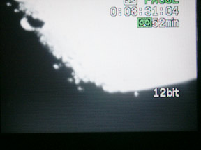
 Here's
a picture before the graze, taking off the small LCD screen of the camcorder,
a few minutes before the graze began.
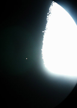
On the right, is a picture through the MaxView 40mm eyepiece and 10" LX200 just after the graze. Note the color of this red giant.
My timings and coordinates are given here:
And here's Walt Morgan's report...
Rick,
"I had given up on this one Monday evening, because the forecast cloud situation looked very bad, and it still looked that way Tuesday morning. Then your note later got me to check cleardarksky once more, and that looked a lot better. So I headed out at 8:45, and had found a dandy spot between two cotton fields east of I-5 by about 11:00.
The graze was excellent. I had the camera near minimum gain, and the seeing was mediocre (high humidity), but the star came booming through. I started to count each event, but lost track completely. I think there were 8 or 10 events all together, three of them very short Ds, including one where the star did not completely fade out. My first D was a few seconds after 8:56, and the last R was near 8:57:30.
>This morning I put my exact coordinates into my worksheet and obtained an
>offset from the predicted graze line that was larger than I had read from
the GPS
>last night. Unfortunately, that means I was very close to your chord. I
>estimate we were 29 miles apart, so there would be slightly different tangents
>for us, but I really should have been a little further north.
>
>The difference in what I calculate this morning versus last night is due
to
>two things:
> I supplied the GPS with coordinates separated 12' in longitude, versus
6'
>this morning;
> I ran Occult obtaining the path coordinates in DD MM SS this morning, which
>gives better precision than the DD MM.M used yesterday.
>
>What that amounts to is:
> GPS indication last night: 0.63 km or 0.38 miles
> Calculation this morning 0.80 km or 0.50 miles
>
>My coordinates were
> Latitude 36 d 43.289' Longitude -121 d 39.733' (+/- 0.002')
> Elevation 125 m (+/- 10, from topomap)
>
>I ran Occult for my elevation of 125 m and for your elevation estimated
to be
>427 m. The differences were small. The offset in our times I calculate to
>be 41 seconds, but I can refine the last fractional second when I have your
>exact coordinates.
>
>Haven't reviewed the tape this morning yet, so don't have an update on the
>number of events. The times are all between about 8h 56m 4s and 8h 57m 30s.
>
>My transfer of 41 seconds to your location then predicts that your times
will
>be betwen about 8h 55m 23s and 8h 56m 49s. That assumes that we were
>really on the same chord, which no doubt is slightly incorrect.
>
>Walt
Thanks for calling this one to my attention.
Walt